
AERIAL GRAPHICS
Enhancing Your View
We add valuable details to
aerial imagery
Sometimes, an aerial image is not enough to
convey a compelling message about your project.
And sometimes, marking up a Google Earth
map doesn’t not tell the whole story.
Our team has been building enhanced aerial
graphics for real estate projects for over
a decade. We integrate a wide array of visual components, including logos, labels,
land use shading, site plans, and floodplain
into aerial maps. If you have data that holds
a spatial component, we can integrate it.
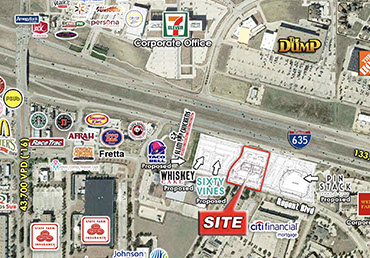
Closeup Aerial
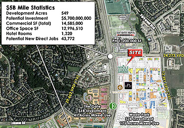
Las Colinas Aerial
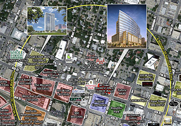
Downtown Austin Aerial
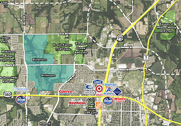
Collin Denton North Aerial
YOUR VISION.
OUR EXPERTISE. BETTER RESULTS.
Let's Get Started On Your Custom Solution Today.
972.499.8100